
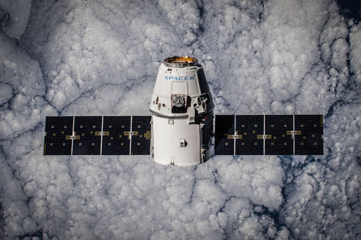
The Earth-imaging satellite launch has successfully placed India in the forefront of space exploration. This milestone demonstrates India’s growing capabilities in satellite technology and geosynchronous orbit placement.
Overview of the Earth-imaging satellite
The recent launch of the Earth-imaging satellite marks a significant achievement in satellite technology and space exploration. This advanced satellite is designed to provide high-resolution images of the Earth’s surface, enabling enhanced monitoring and analysis of environmental changes.
Key features of the Earth-imaging satellite include:
- High-resolution imaging: Capable of capturing detailed images, allowing for precise data collection.
- Geosynchronous orbit: Positioned to maintain a constant view of specific regions, providing consistent data over time.
- Advanced sensors: Equipped with cutting-edge technology for better atmospheric and land analysis.
This Earth-imaging satellite launch is expected to greatly benefit various sectors, including agriculture, urban planning, and disaster management, emphasizing its role in supporting sustainable development efforts worldwide.
Significance of the launch for India
The recent Earth-imaging satellite launch marks a significant milestone for India, enhancing the country’s capabilities in remote sensing and geospatial technology. This advancement is crucial for various sectors, including agriculture, urban planning, and disaster management.
With improved imaging capabilities, India can monitor environmental changes and assess natural resources more effectively. The satellite’s high-resolution imagery will aid in:
- Agricultural monitoring: Farmers can receive timely information on crop health and soil conditions.
- Urban development: City planners can utilize precise data for sustainable development.
- Disaster response: Enhanced situational awareness during natural disasters can lead to quicker and more effective responses.
Moreover, this successful mission solidifies India’s position as a key player in satellite technology, fostering international collaborations and boosting the nation’s technological prowess.
Technical details of the satellite
The recently launched Earth-imaging satellite is equipped with advanced technology to enhance its observational capabilities. This satellite operates in a geosynchronous orbit, allowing it to maintain a consistent position relative to the Earth’s surface. Key features include:
- High-resolution imaging: The satellite can capture images with remarkable detail, aiding in various applications such as agriculture, urban planning, and disaster management.
- Multi-spectral sensors: It is fitted with sensors capable of capturing data across different wavelengths, providing comprehensive insights into land use and environmental changes.
- Real-time data transmission: The satellite is designed to relay information quickly, enabling timely responses to natural disasters and other urgent situations.
- Robust power systems: Equipped with solar panels, the satellite can sustain its operations in space for an extended period.
This launch marks a significant milestone in India’s efforts to strengthen its capabilities in Earth observation through its innovative Earth-imaging satellite.
Future missions planned by India
India’s recent Earth-imaging satellite launch marks a significant step forward in its space exploration efforts. Following this successful mission, the Indian Space Research Organisation (ISRO) has outlined several future missions aimed at expanding its capabilities in satellite technology.
Key plans include:
- Enhanced Earth Observation: Future satellites will focus on high-resolution imaging to support agriculture, forestry, and urban planning.
- International Collaborations: ISRO aims to partner with other countries for shared satellite missions, enhancing data collection and research opportunities.
- Advanced Remote Sensing: New technologies will be integrated into upcoming satellites, allowing for more accurate environmental monitoring.
These initiatives reflect India’s commitment to leveraging space technology for national development and global cooperation, ensuring that the momentum from the recent Earth-imaging satellite launch continues into the future.
International implications of the launch
The recent Earth-imaging satellite launch by India marks a significant milestone not only for the country but also for international collaboration in space technology. As nations increasingly rely on satellite data for environmental monitoring, disaster management, and urban planning, this launch enhances India’s position in the global space community.
Many countries are expected to benefit from the high-resolution images and data provided by the satellite, which can be utilized for various applications including agriculture, forestry, and climate research.
Moreover, the success of this mission demonstrates India’s growing capabilities in space exploration, prompting other nations to consider partnerships for future projects.
Furthermore, the ability to monitor global environmental changes will foster international dialogue on climate action and sustainable development, underlining the importance of collaborative efforts in addressing global challenges.
Challenges faced during the launch
The recent Earth-imaging satellite launch was not without its challenges. Numerous factors had to be meticulously managed to ensure the mission’s success.
- Weather Conditions: Unpredictable weather patterns posed a risk to the launch schedule, necessitating last-minute adjustments.
- Technical Glitches: There were minor technical issues during the final countdown that required immediate troubleshooting by the engineering team.
- Coordination Efforts: Synchronizing the various teams involved, from ground control to satellite engineers, demanded excellent communication and collaboration.
- Resource Allocation: Efficient distribution of resources was crucial, especially as the launch approached, to mitigate any last-minute shortages.
Despite these hurdles, the team’s dedication and expertise ensured the Earth-imaging satellite was successfully placed in geosynchronous orbit, marking a significant milestone for India’s space program.
Expert opinions on the satellite’s capabilities
Experts have praised the recent Earth-imaging satellite launch, highlighting its advanced capabilities and potential impact on various sectors. Dr. Anjali Rao, a leading space technology analyst, stated, “This satellite is a game changer for agricultural monitoring and disaster management. Its high-resolution imaging will provide critical data to farmers and emergency services.”
Additionally, Professor Vikram Singh, an aerospace engineer, emphasized the importance of the satellite’s geosynchronous orbit, noting, “This position allows for continuous observation of specific regions, enhancing real-time data collection.”
Furthermore, environmental scientist Dr. Meera Joshi added, “The Earth-imaging satellite will significantly contribute to climate research by providing valuable information on land use and environmental changes.”
Overall, the satellite’s capabilities are expected to foster advancements in agriculture, urban planning, and climate monitoring, solidifying India’s position in the global space arena.
The recent Earth-imaging satellite launch has provided invaluable data for climate monitoring and disaster response. Experts are already calling this Earth-imaging satellite launch a smart proven success in advancing our understanding of the planet.
Photo by SpaceX on Pexels